
Geotagging with Flickr
Flickr added a Geotagging feature recently. I can now add my photos to the map in a few easy steps. Of course, you can do the same thing using Google Earth Panoramio KML Feed, but I prefer the simplicity of Geotagging in Flickr.
To geotag a photo, you just need to
To geotag a photo, you just need to
- Sign in to you account.
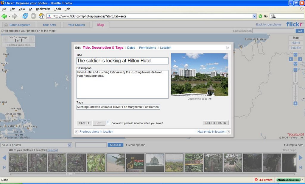
- Go to Organize Tab> Your Sets> Map
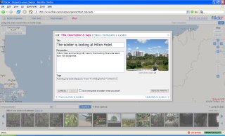
- Look for the photos that you want to add to the map. You can use the Search feature. For example, I search for photos tagged with "Kuching" which were taken during my Sarawak trip. Thus, I can add them all as a batch to Kuching location map.
- Since it is Ajax driver, you can just Drag and Drop the photo to a specific location where it is taken.
- Voila. Done!
Tha latitude and longitude of the location will automatically be saved. For sure, you still can edit the title, description, tags, dates and permissions of the photo which you have set earlier during the uploading process.
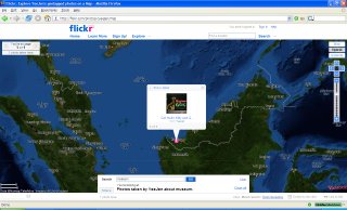
The location area is available in Map, Hybrid and Satellite modes. But, it has no difference to me since the coverage for Malaysia in Yahoo! Map is not detailed enough. Check out Flickr Geotag Screencast Part 1 and Part 2 to know more about it. In conclusion, I like this feature because we can only have bird's-view of map and geotagged photos can be treated as the street-level view of a specific place.
Have a great time travelling on Flickr Map!
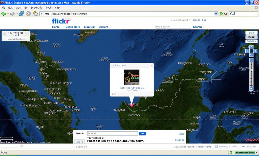
posted by YeeJen at 2:49:00 PM
![]()
![]()

1 Comments:
Hi Yeyeen,
I believe Flickr Maps and Panoramio are focused in different scenarios of use. Flickr Maps interface is good for massive geotagging, but of course that means low accuracy in location, because most of Flickr users don't want to use very much time finding the right location. Also the poor coverage of Yahoo Maps doesn't allow very much accuracy. Just take a look in London, for example, and you will find many misplaced photos.
Panoramio is focused in accuracy in geotagging, what it is easier to do with Google Maps good coverage. In Panoramio the community suggest new locations to misplaced photos.
Regards,
Eduardo
Post a Comment
<< Home